Our Latest
Geological and Geophysical Exploration Products
Resistivity Meter
The Smart Geo Explorer (GE-1) is a multipurpose geophysical measuring equipment. High speed ARM microprocessor based geophysical data acquisition system. GE-1 capable to interact and display parameters chart in Android device and window based laptop, the instrument designed to get more accurate, stable and repeatable reading for each measuring point. Signal stacking up to 15 successive readings to get averaged value of each measuring point. GE-1 haves power unit for multilevel voltage supply to ground depending on lithological conditions. GE-1 can be used for measure resistance up to 500m under favourable conditions.
Automatic Digital Well Logger
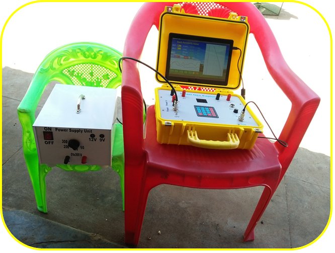
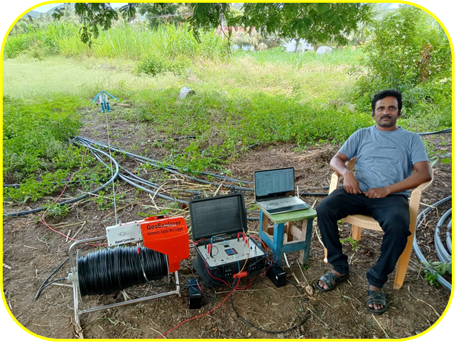
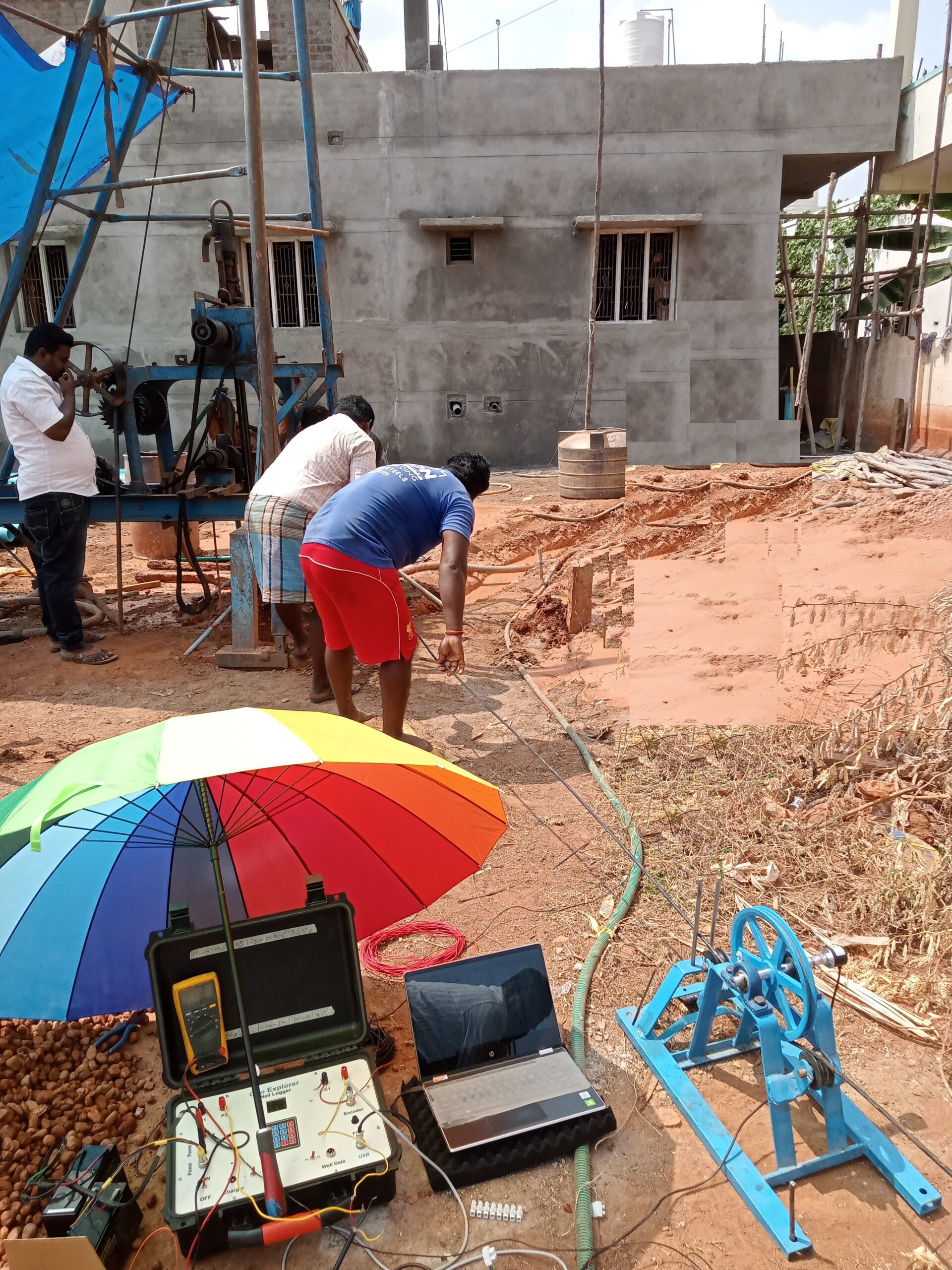
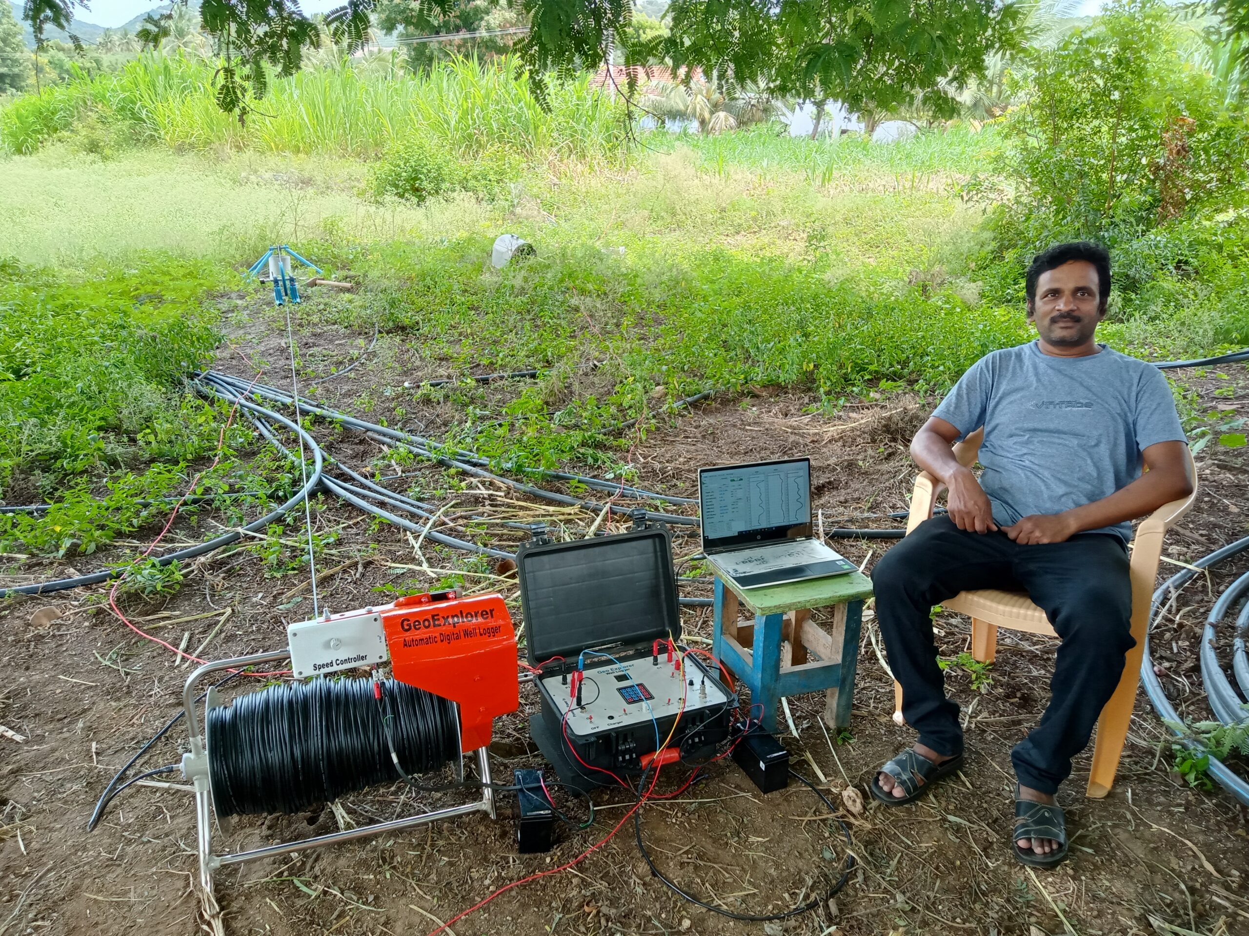
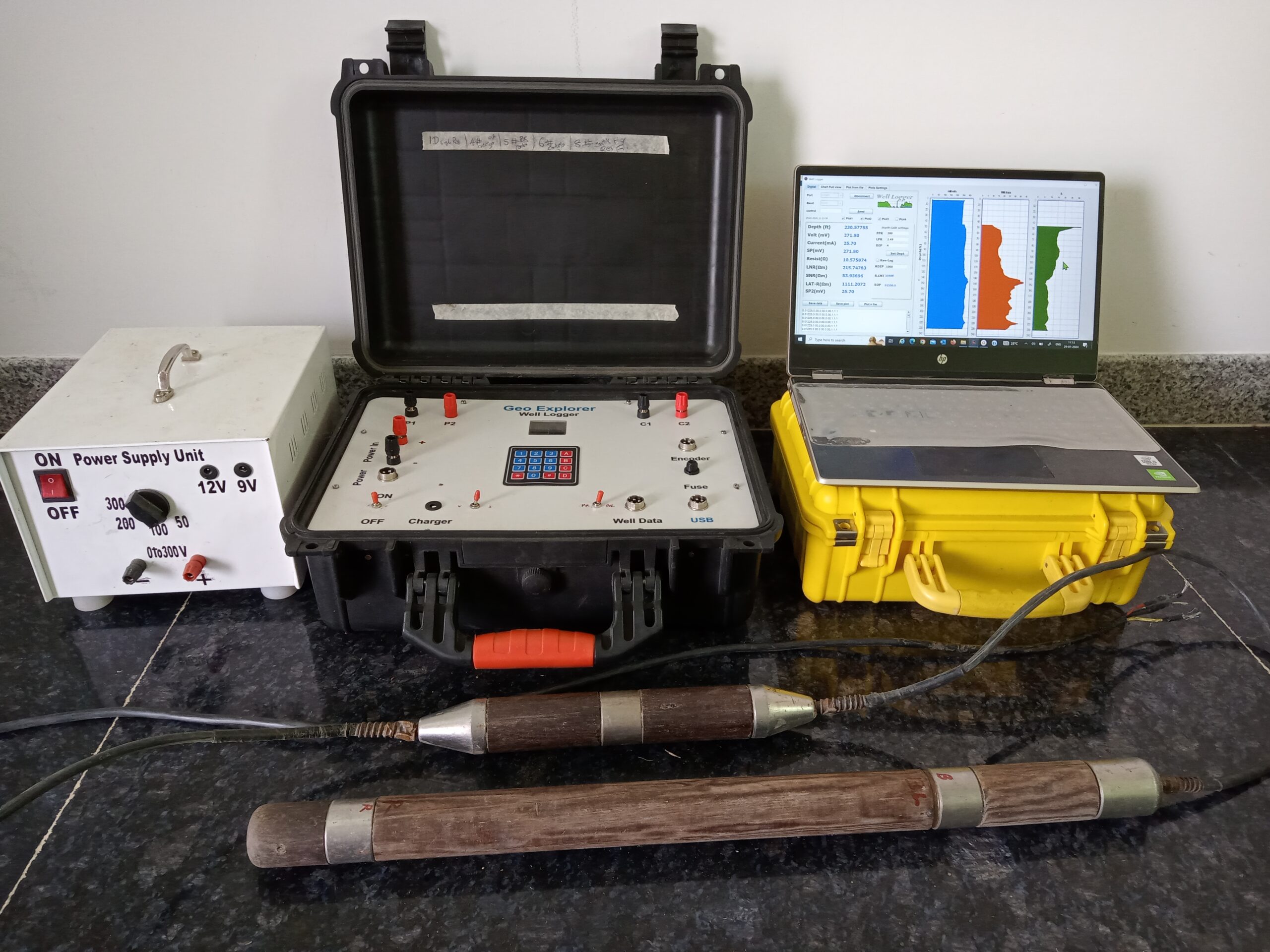
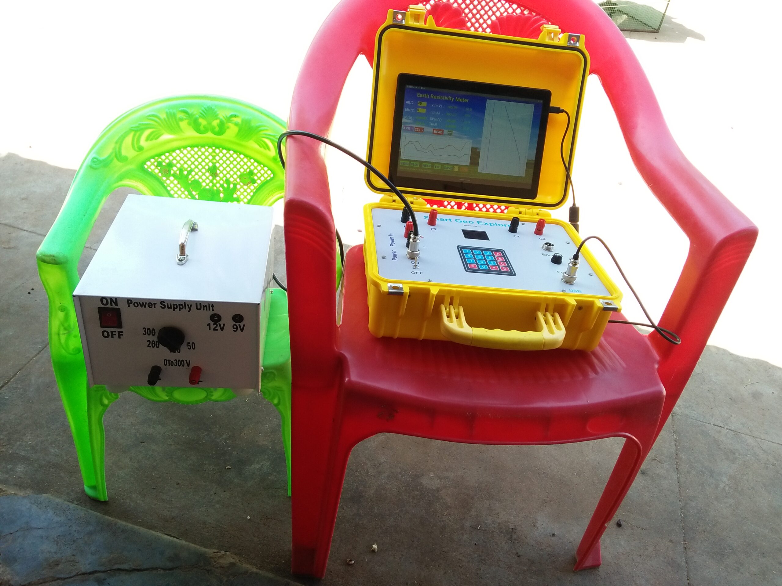
The Automatic Digital Well Logger is a high-performance logging system designed for precise, reliable, and repeatable subsurface data acquisition. It features high-resolution digital logging with a high-frequency data recorder capable of capturing up to 15 measurements per second, ensuring detailed and continuous formation evaluation.
With a logging speed of up to 75 ft/min and a fine 0.1 ft depth resolution, the system delivers accurate depth correlation and exceptional data clarity. Its advanced electronics provide high stability and measurement reliability, resulting in consistent performance under demanding field conditions.
The logger offers excellent repeatability, producing accurate and well-matched logging data on repeat runs, making it ideal for quality-critical well logging applications. This combination of speed, precision, and data integrity ensures dependable results for groundwater, geotechnical, and borehole logging operations.
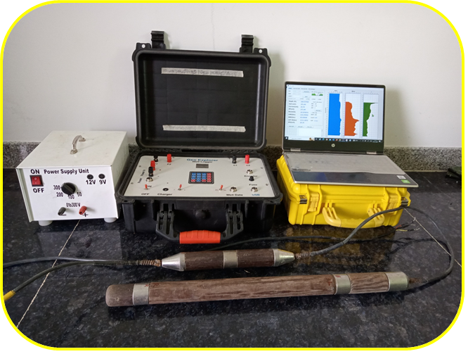
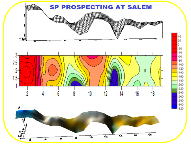
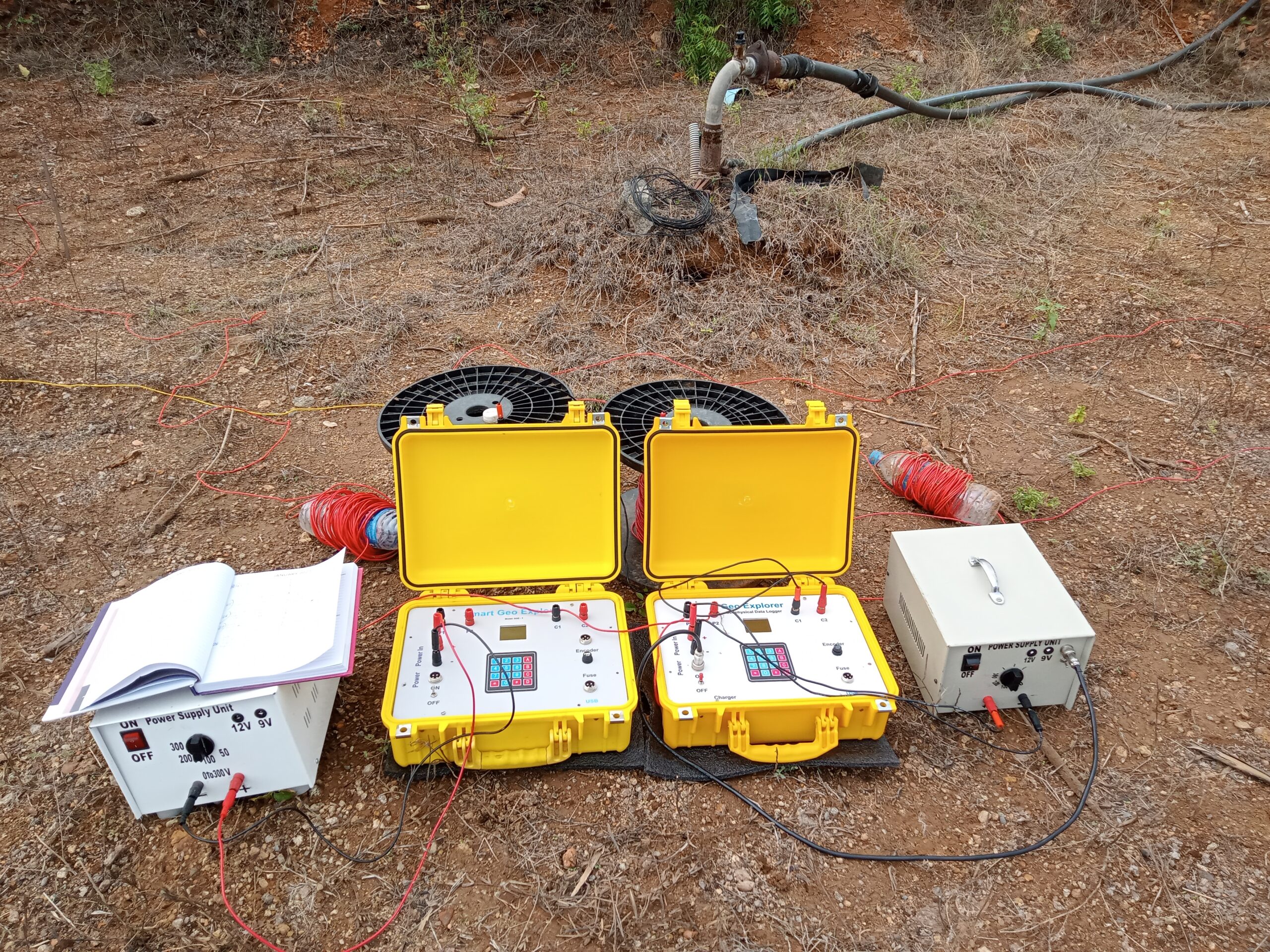
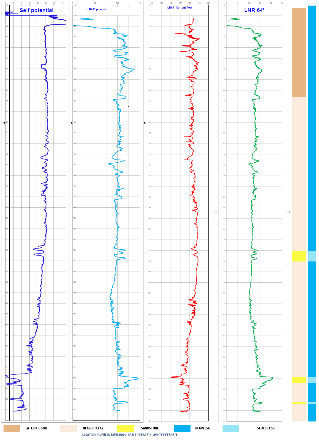
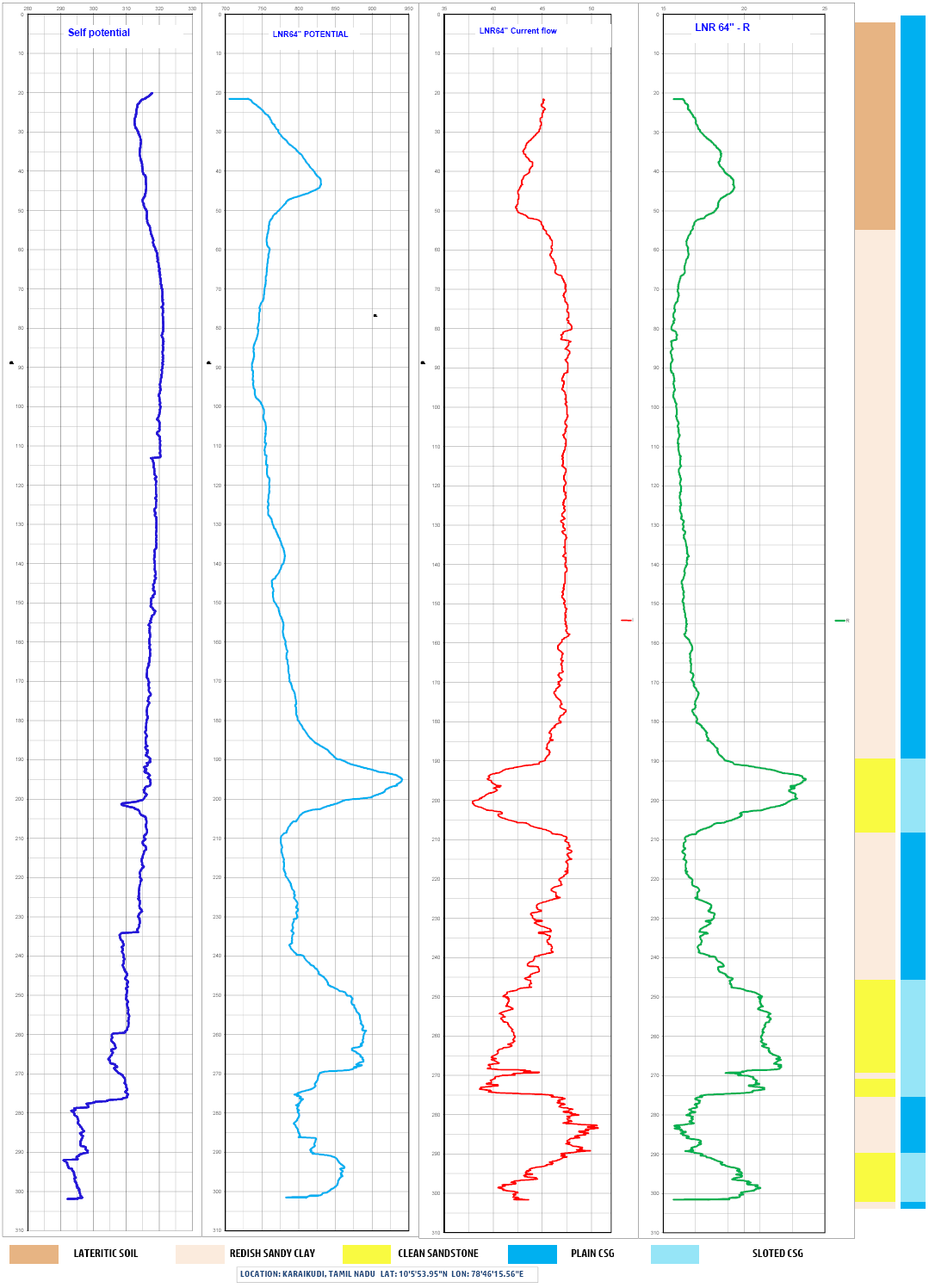
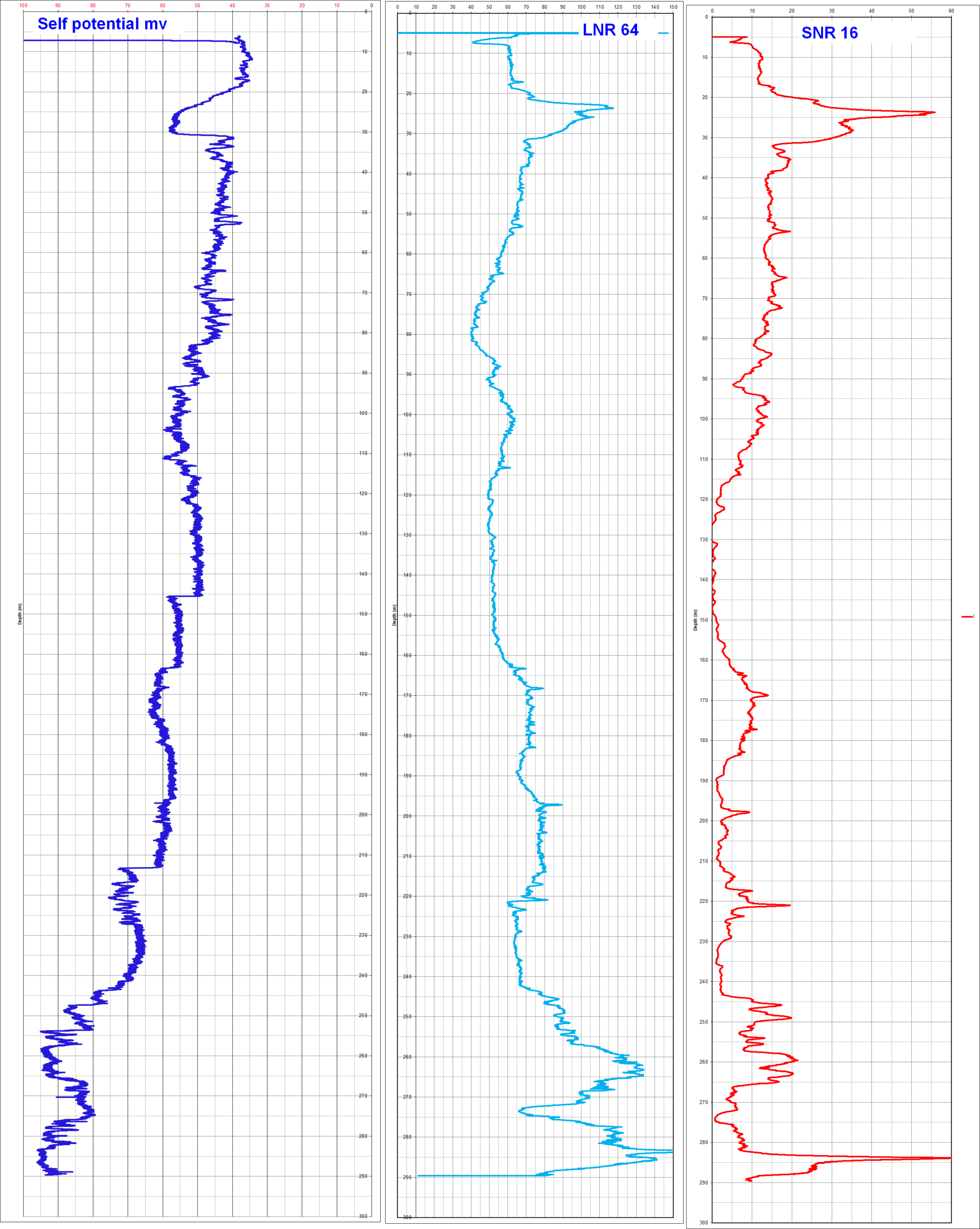
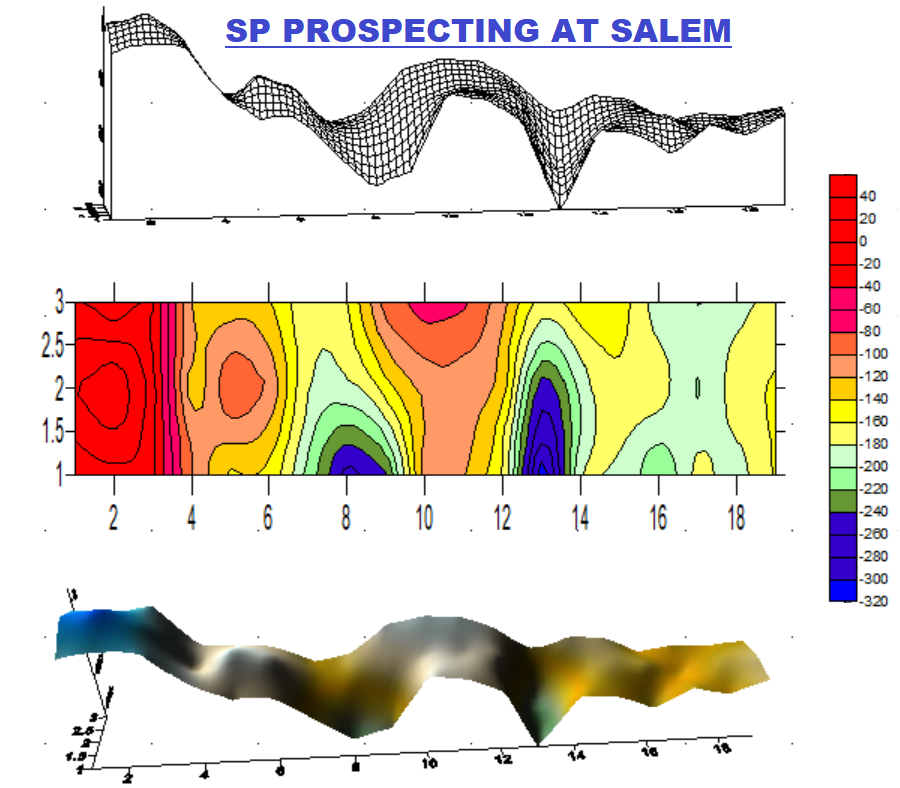
Self potential (SP), Long Normal Resistivity (LNR), Shotr Normal Resistivity (SNR), Lateral Resistivity, Single Point Resistivity (SPR). can record,
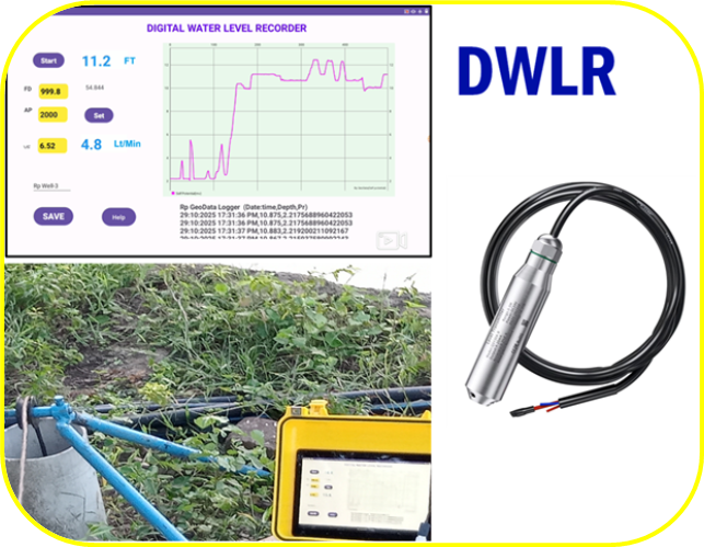
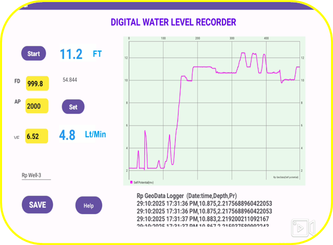
With Sensor Probe, Temprature, TDS, EC, Turbidity can record. real time chart will display while logging.
Electrical Resistivity Tomography (2D ERT)
Electrical Resistivity Tomography (2D ERT) equipment is an advanced geophysical surveying system used to investigate subsurface conditions by measuring variations in electrical resistivity. The system operates by injecting a controlled electrical current into the ground through a series of electrodes and measuring the resulting voltage differences. These measurements are processed to generate a two-dimensional resistivity image that represents subsurface layers and structures.
Uses and Fields of Application:
2D ERT is extensively used in groundwater exploration to identify aquifers, fracture zones, and water-bearing formations. In geological and geotechnical investigations, it helps determine soil stratification, bedrock depth, faults, and weak zones. For environmental studies, 2D ERT is effective in detecting contamination plumes, landfill boundaries, and saline intrusion. It is also applied in engineering and construction projects for site investigation, foundation assessment, and tunnel alignment, as well as in mining and infrastructure studies to locate voids, cavities, and subsurface anomalies.
The method is non-invasive, cost-effective, and provides reliable subsurface imaging, making 2D ERT a valuable tool for a wide range of field applications.
Self Potential(SP) Prospector
The Self Potential (SP) Prospector is a passive geophysical surveying instrument used to measure natural electrical potentials that occur in the ground due to electrochemical, electrokinetic, and thermoelectric processes. Unlike active methods, the SP Prospector does not inject current into the ground; instead, it detects naturally occurring voltage differences between electrodes, providing valuable information about subsurface conditions.
Uses and Applications:
SP Prospecting is widely used in mineral exploration to detect sulfide mineralization and ore bodies associated with natural electrochemical activity. In groundwater investigations, it helps identify groundwater flow paths, seepage zones, fractures, and leakage in dams and embankments. The method is also applied in geothermal exploration to locate zones of fluid movement and thermal anomalies. Additionally, SP surveys are used in environmental and engineering studies to detect buried metallic objects, assess corrosion activity, and monitor subsurface fluid migration.
The SP Prospector offers a non-invasive, cost-effective, and efficient solution for mapping subsurface electrical anomalies related to fluid flow and mineralization.
Advantages: No need of Power or charges to equipment as it is using smart device to plot and Logging data
Digital Water Level Recorder (DWRL)
The Digital Water Level Recorder (DWRL) is a precision monitoring instrument designed for continuous and accurate measurement of water levels in wells, boreholes, reservoirs, and surface water bodies. It uses high-resolution digital sensors to record water level fluctuations over time, storing reliable data for analysis and long-term monitoring.
The DWRL provides stable, repeatable measurements with excellent accuracy, making it suitable for both short-term surveys and extended deployment in field conditions. Recorded data can be easily downloaded for interpretation, supporting effective water resource assessment and management.
Uses and Applications:
Digital Water Level Recorders are widely used in groundwater monitoring to observe aquifer behavior, recharge rates, and seasonal water level variations. They are essential in hydrological and environmental studies for monitoring rivers, lakes, and reservoirs. In water supply and well management, DWRLs help evaluate pumping tests, drawdown, and recovery. They are also used in research, irrigation planning, and flood monitoring to provide accurate, continuous water level data for informed decision-making.
Projects
Have a Look at Geo Explorations
Below all our Recent Exploration works
Electrical well logging conducted in various part of Tamil Nadu, India. 2D ERT (Electrical Resistivity tomography), ERI, SP prospecting, Resistivity survey for water divining, Geo technical investigation, mining subsurface investigation using Resistivity meter and 2D ERT equipments, geophysical exploration for environmental study, bore well drilling logging for mineral exploration and coal mining, dam safety investigation using SP prospector and 2D ERT.


